

An average tourist associates Lazio with Rome; the Italian capital is its main attraction. But what if you’re into hikes near Rome? You’ll find hundreds of hiking trails in Lazio, from easy and short to more challenging and longer.
The Cammino dei Tre Villaggi (Three Villages Trail) is one of the longer. It connects three villages through diverse terrain and 2,500-year-old Etruscan tombs near Rome carved into the rock. And although it’s 20 km long, it can be walked in sections.
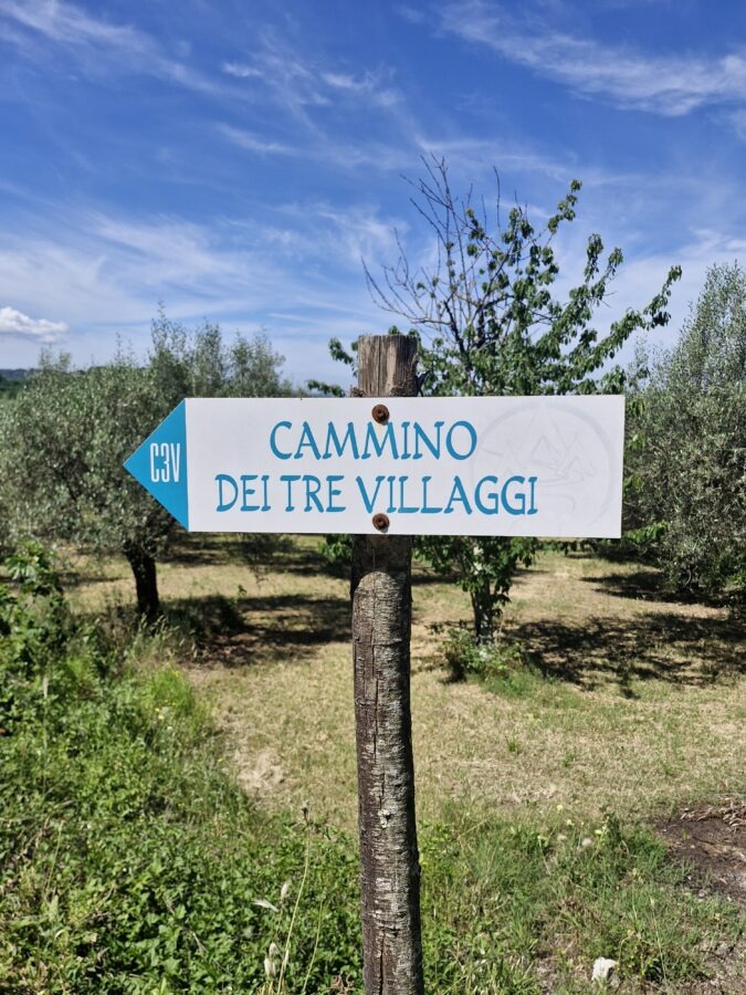
Cammino dei Tre Villaggi guide: Hiking Near Rome
- Trail Name: Cammino dei Tre Villaggi (Three Villages Trail)
- Location: Tuscia, Viterbo Province, Lazio (1.5 hours north of Rome)
- Total Distance: 20 kilometers (12.4 miles)
- Terrain Type: Volcanic tufa gorges, riverbeds, forest, medieval town stone
- Key Highlights: Monumental Etruscan rock-cut tombs, Marturanum Regional Park, Biedano Gorge, 3 medieval villages
- Pilgrim System: Features a €5 physical credential passport with stamps collected at local village checkpoints
Locals know this trail, but foreigners are generally unaware of it. Understandably, tourists don’t usually come to Italy to walk 20 kilometres. But if you’re looking for something a little different, and you like moving, Cammino dei Tre Villagi can offer an off-the-beaten-path perspective on Lazio. And if you are into so-called ‘hidden gems’, well, this one near Rome is literally partly hidden.
Starting the Cammino dei Tre Villaggi: Practical Info & Passport
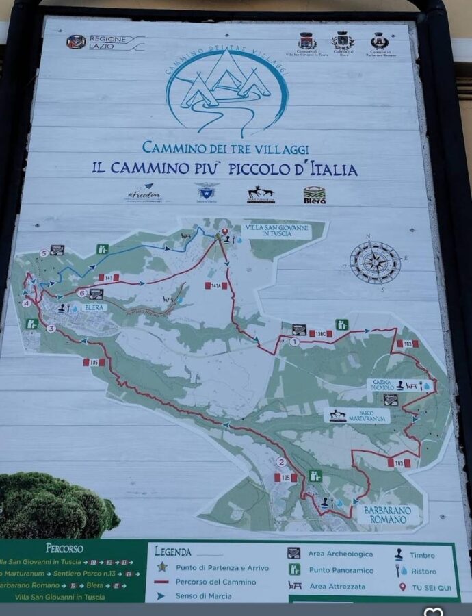
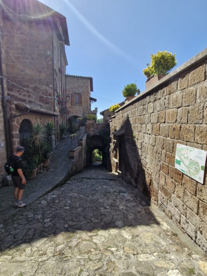
The Cammino dei Tre Villaggi hiking trail starts in Piazza Savoia in Villa San Giovanni in Tuscia and ends there as it goes around.
The concept is similar to the famous Camino de Santiago in Spain, but the trail is just a few hundred kilometres shorter. You can also obtain a pilgrim/hiker passport (costs 5 euros) and collect stamps in the villages along the trail. You can even book accommodation on the way if you want to feel more Spain-like and walk the 20 km in two or three days.
When you finish the path, drop your passport in the designated mailbox at the end to receive your “Etruscan Wayfarer” certificate (Testimonium).
Part 1: Villa San Giovanni in Tuscia to Barbarano Romano (9.2 km)
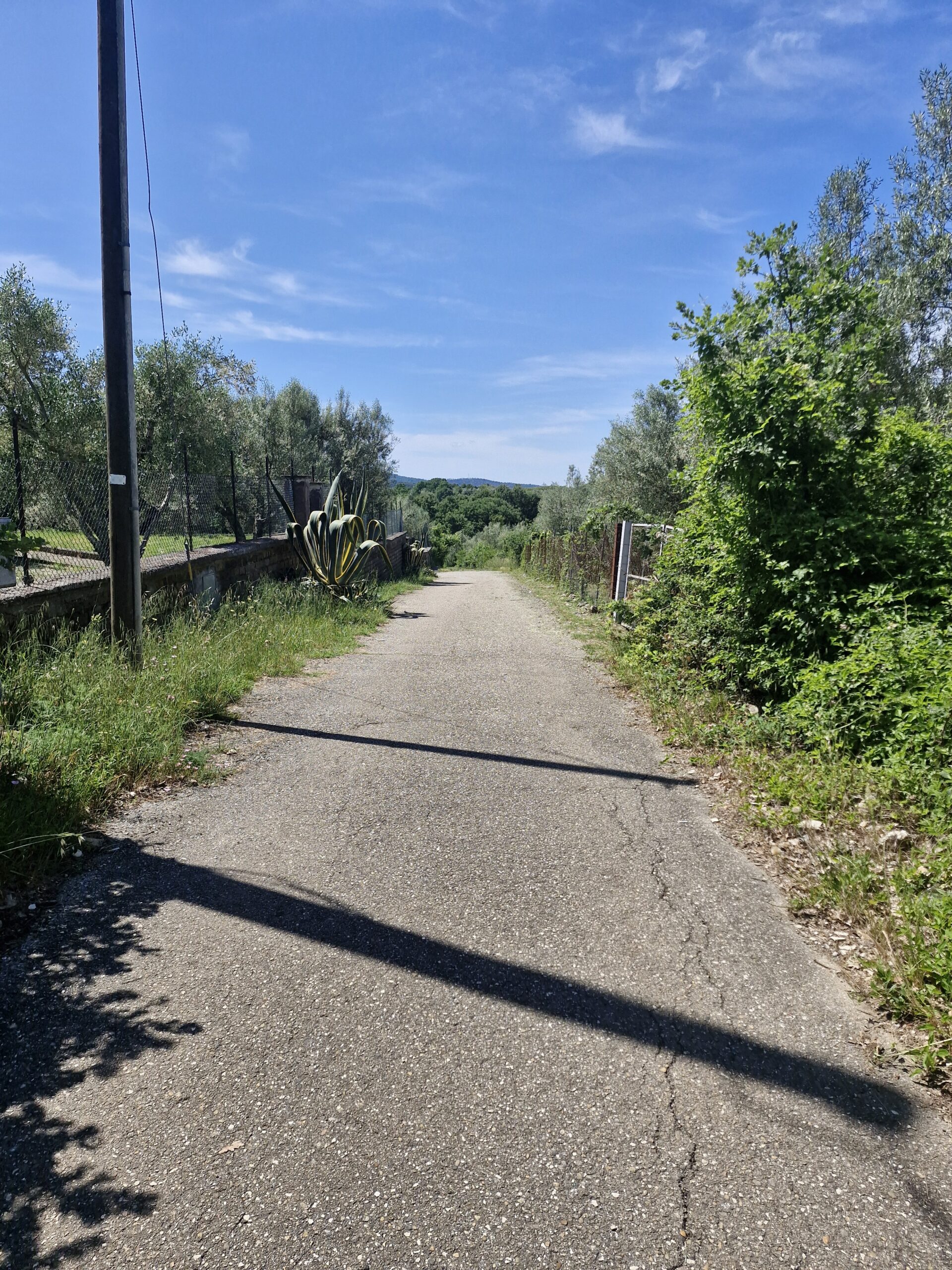
We left the car in a large, free parking lot and set off in the opposite direction from the town. The first section was simply a wide, paved road. Soon, we reached the end of the village – there, the first sign appeared, confirming that we were on the right track. Passing between a few houses and fields of yellow grains was pleasant.
As we crossed the road, we saw a sign indicating our path and Cava delle Quercete in the opposite direction.

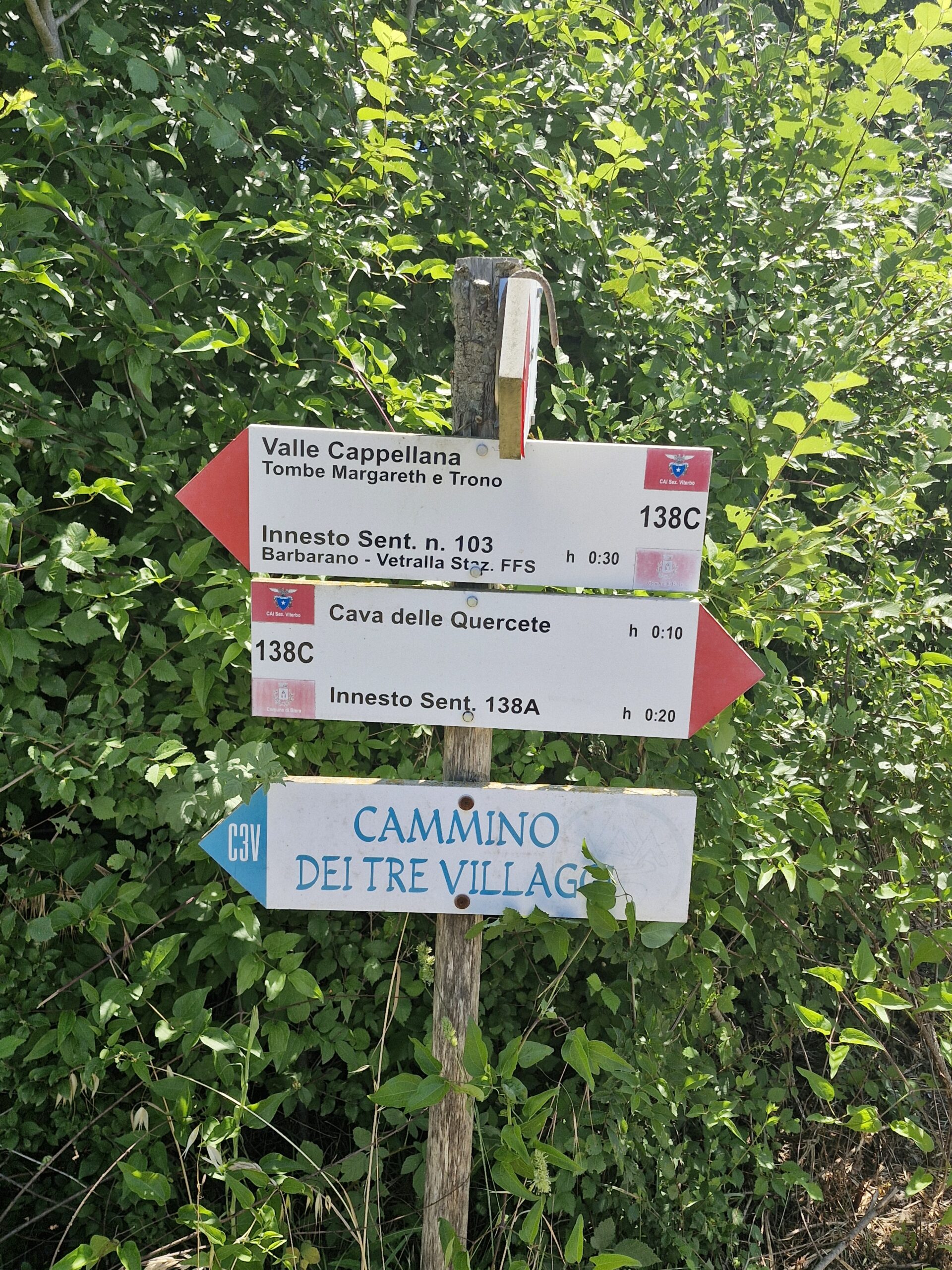
Since it was only a 10-minute walk (according to the sign), we decided to get off the track and check the cave out. I think no one had been using the cave path since at least the Middle Ages – high grass, dry branches lying around, and, of course, an inseparable element of nature – annoying flying things called insects.
After more than 10 minutes of walking, we saw another sign- the cave was another 15-20 minutes away. Ugh, no cave then, but OK- our goal was the Three Villages Trail. We got back.
It was a sunny day, and as I walked through meadows and fields, I started complaining about the sun. I always do that when it gets too strong, and I didn’t have my brand new hat.
Anyway, after a while of walking, we reached Valle Capellana and a very old Etruscan Tomba Margaretha.
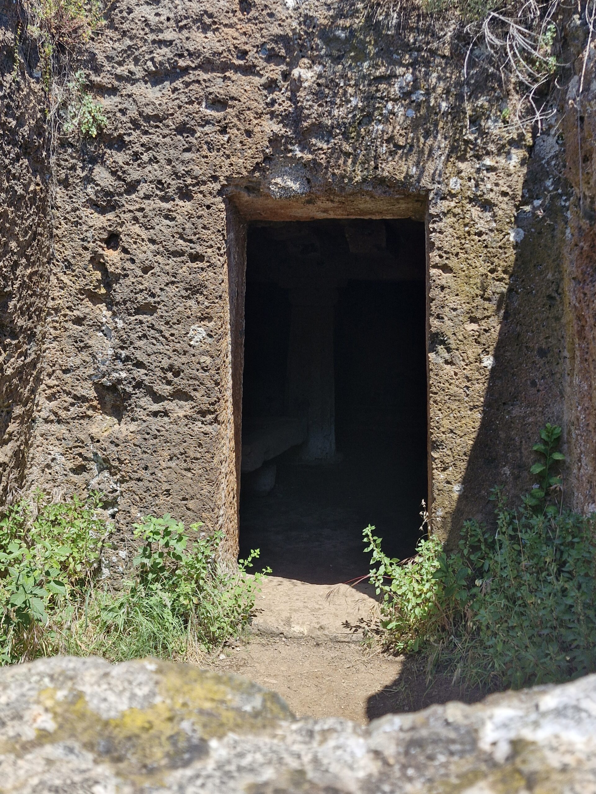
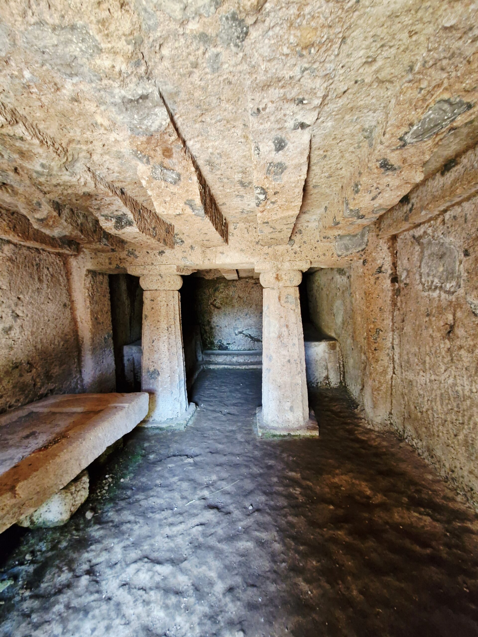
Dating back to the 7th-6th centuries BC, it’s quite nice inside—if such things can be nice at all. There are two “hand-made” columns—yes, limestone or sandstone isn’t a hard material, but I imagine those crazy people from BC, pounding the rock with small hammers to shape it. Such great, long-lasting fun. But thanks to these weird people, at least we have a lot of historical monuments.
Next on the way was Ville Cappellana with the Tomba del Trono—similar to the previous one, so we saw it very quickly.
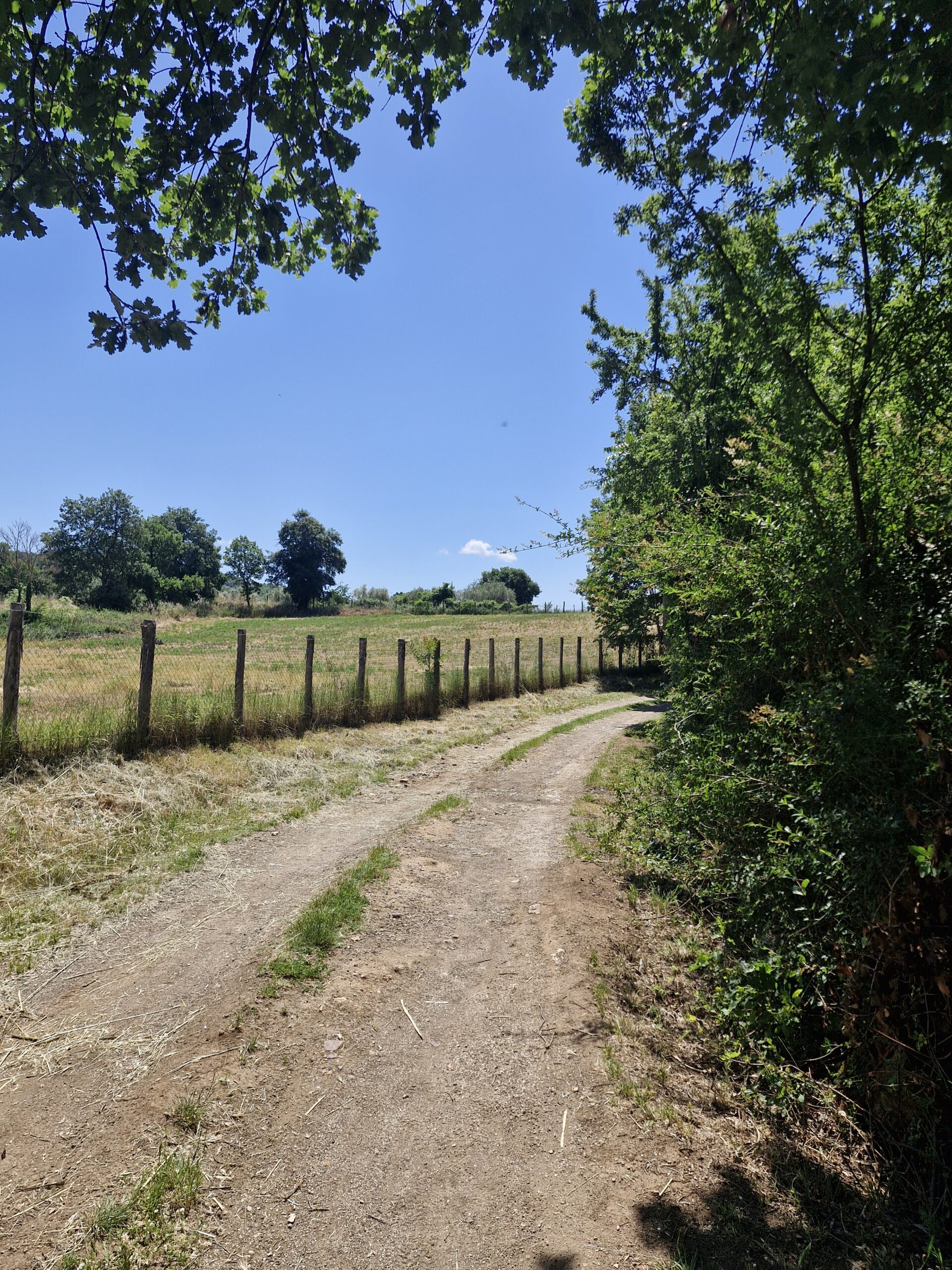
Following a dirt path, we reached a road and then the forest – the path led us to our first rest area. Emerging from thebushes, we saw many cars and even more people – many take day trips from Rome, doing a part of the trail or just exploring the area.
There’s a kiosk where you can get your passport stamped and grab a bite to eat and a drink. We wanted to buy water, but the ladies at the kiosk panicked because of the number of people and refused to serve anything. Nice. Anyway, we stopped there for lunch, a quick rest, and to air our feet before stepping down into the land of Etruscan tombs.
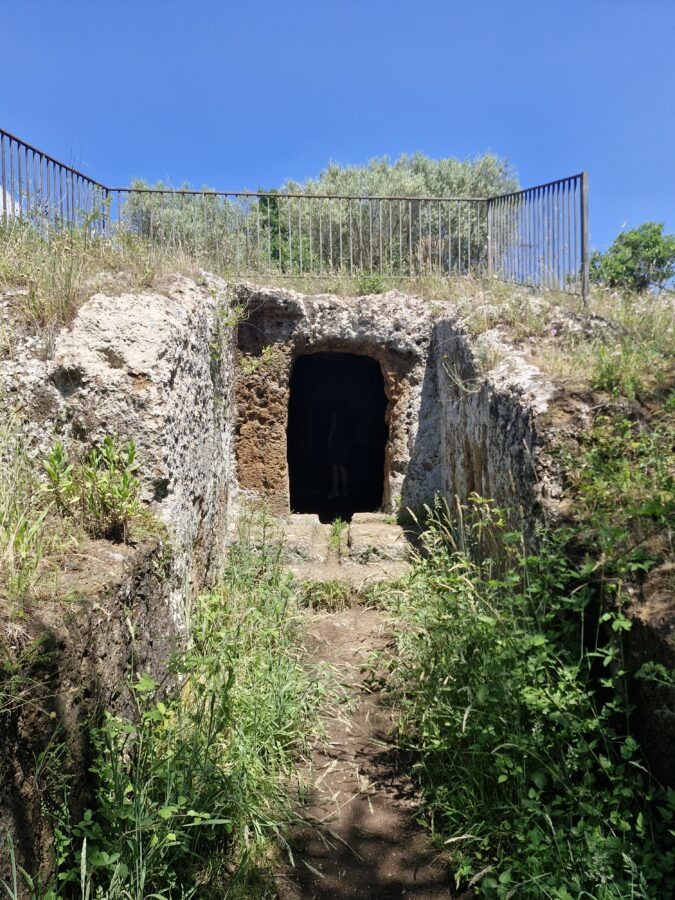
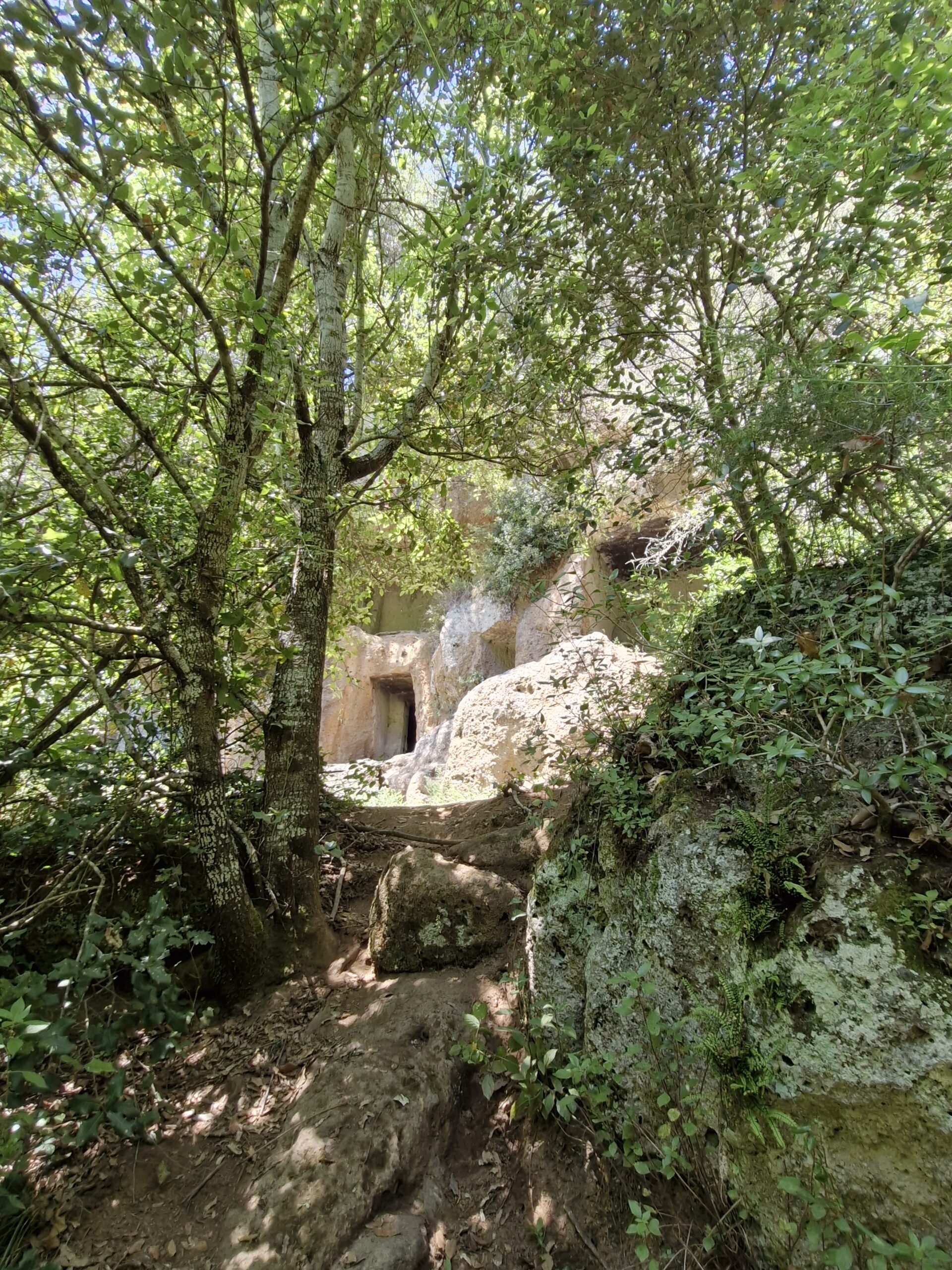
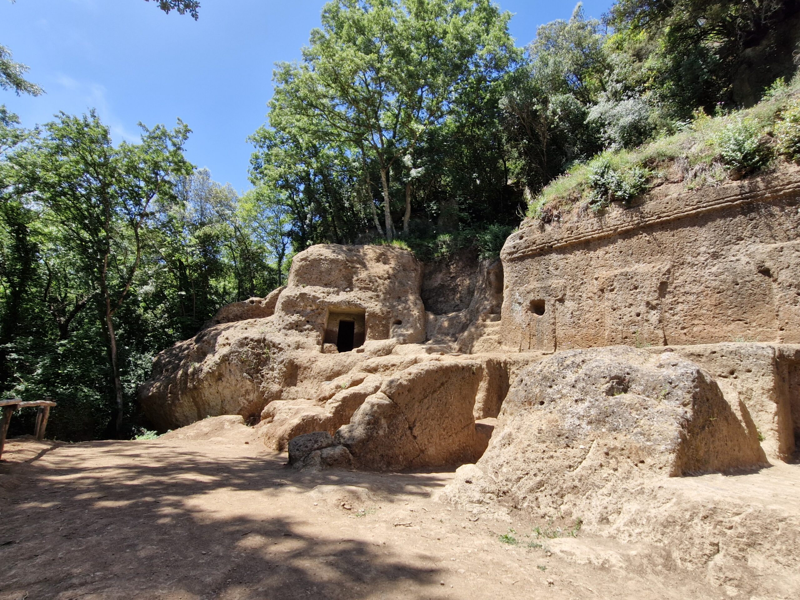
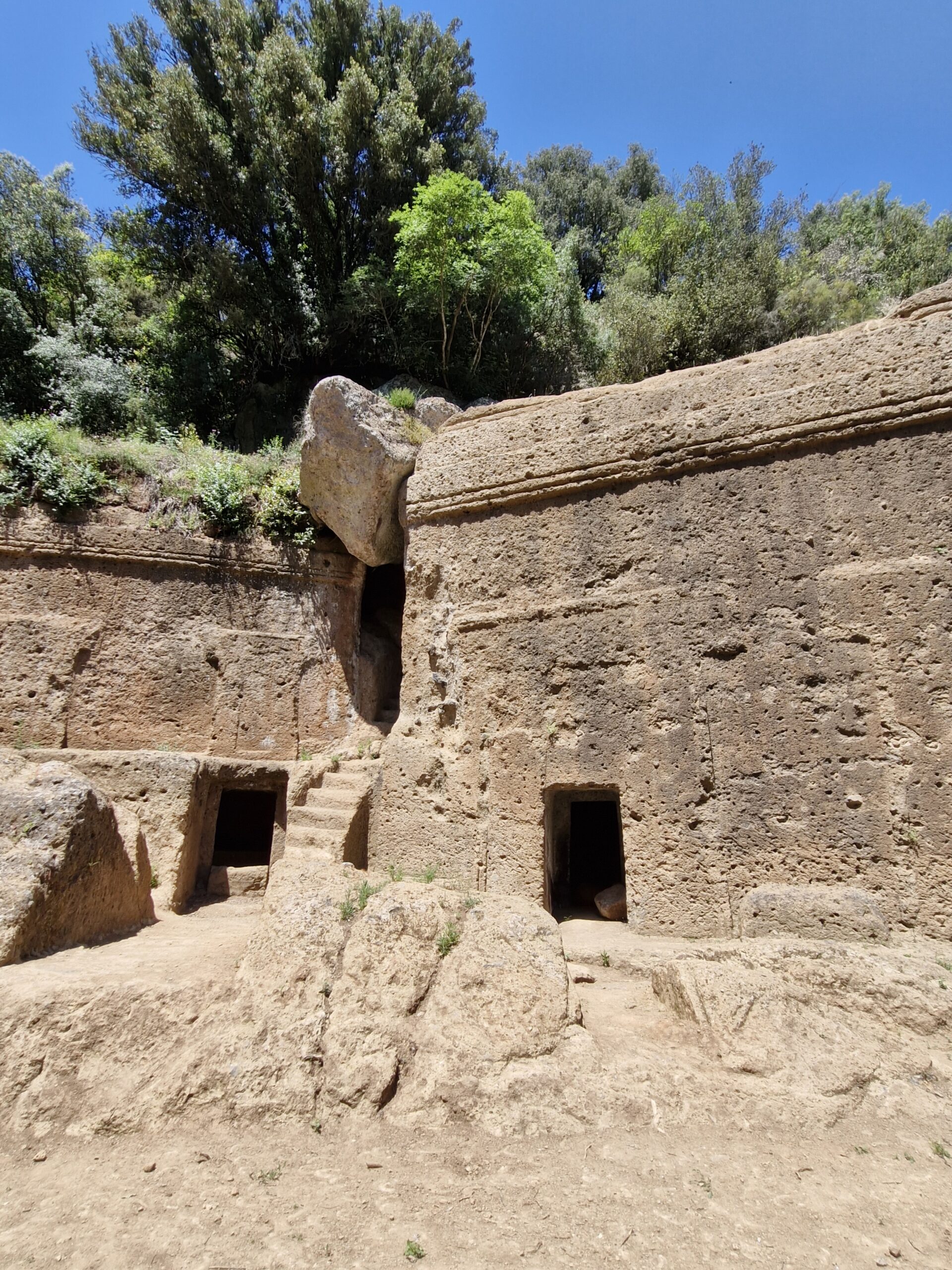
Seriously, the next section of the path is one giant necropolis—tombs carved into the rocks are everywhere. Some look like modern Italian cemeteries—the graves are stacked two, three stories high. They’re impressive, ancient, surrounded by the jungle-like greenery of the Marturanum Regional Park. And more or less the same—hand-carved holes in the rocks – visiting a few of them was enough for me.
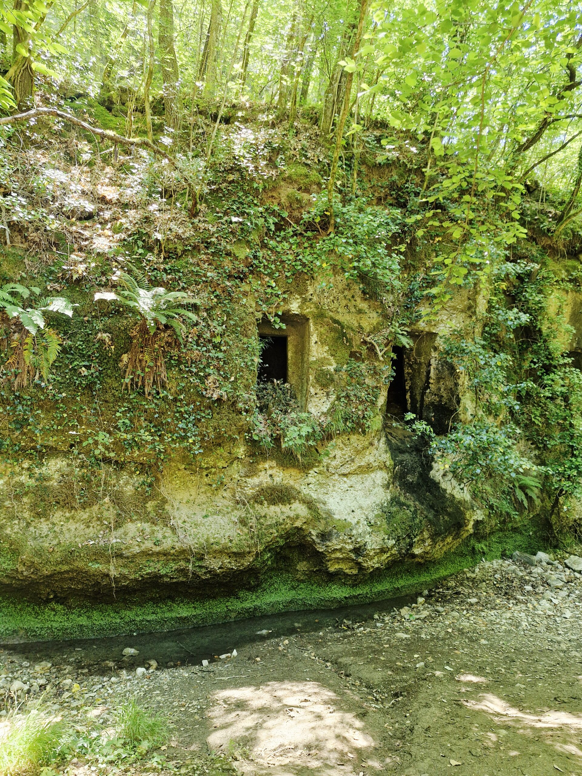
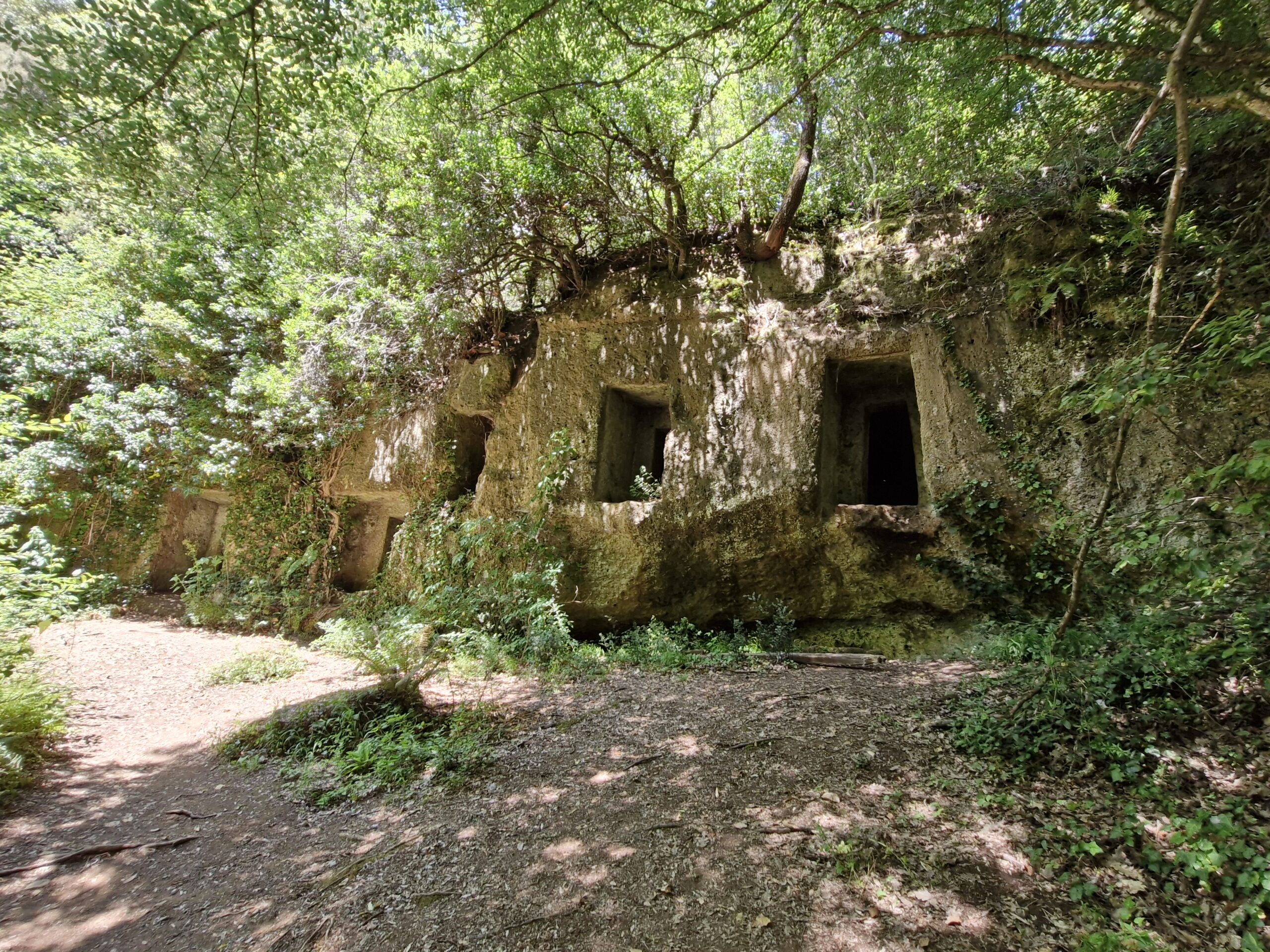
So when I saw the path to the next tomb, I just wanted to skip it. But because this mausoleum looked different from the others, we checked it out. It was a stunning structure, reminding me of Egypt: I don’t know why, maybe it was the colour of the rock, but that was my first thought. The Tomba della Regina (Queen’s Tomb) is large, so there was enough room to bury other queens and kings with their families, friends, and even pets.
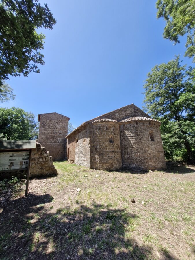
Continuing on, we saw the ancient city of San Giuliano and a medieval church. We also wanted to reach the walls of what was probably a castle, which we saw from the road, but it was impossible.
Since this was a land of tombs, there were more of them. The Etruscan City of the Dead is a series of caves in the rocks on several levels. I saw a few, Mauro – all of them. I like history, but honestly, I don’t see any reason to get excited about every single hole/cave in the wall, especially since they all look more or less the same, and Lazio is full of them. But that’s me.
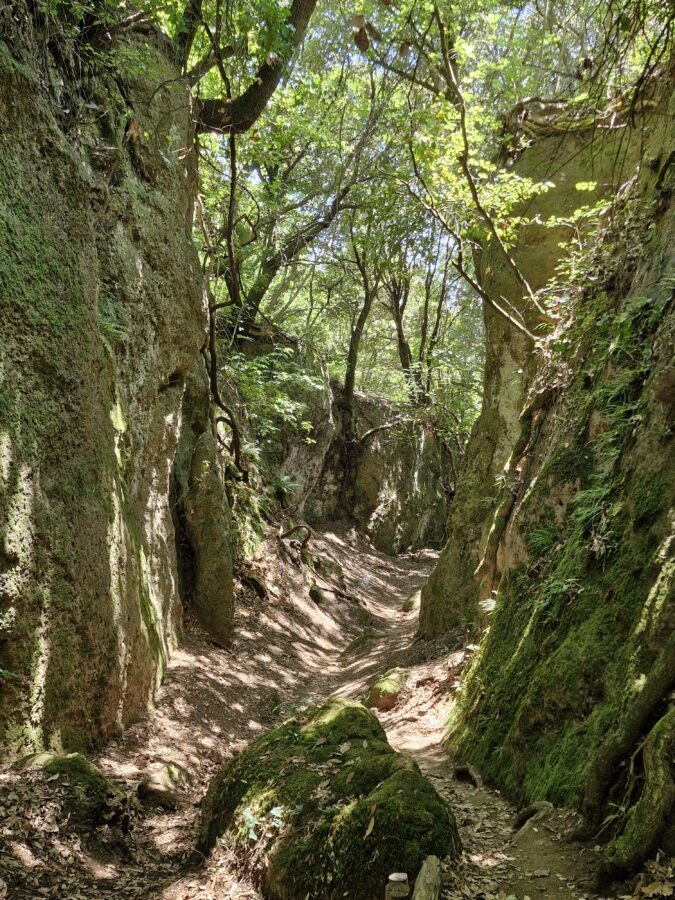
From the tombs, we got a road that led us into another forest and canyon. Descending, we began to feel like we were running out of water (we each had a liter), but fortunately, the canyon was close to the village of Barbaro Romano.
Then, we only had to climb up the stairs, walk a few meters, and we could sit at a café, enjoying cold drinks, a piece of cake, and a chat with other hikers. We bought two large bottles of water—just in case, because the water from all the fountains along the trail is undrinkable.
Part 2: Barbarano Romano to Blera (5.4 km)
One of the young hikers began to panic that the next bit of road to Blera was very difficult or even dangerous. That’s what he’d heard. We looked at each other—even if that were true, we didn’t have much choice—either turn back or continue.
The path to Blera goes exclusively through the forest, which is good because there is no crazy sun here. Was it difficult or even dangerous? Not really, however, it was more difficult comparing the the previous part.
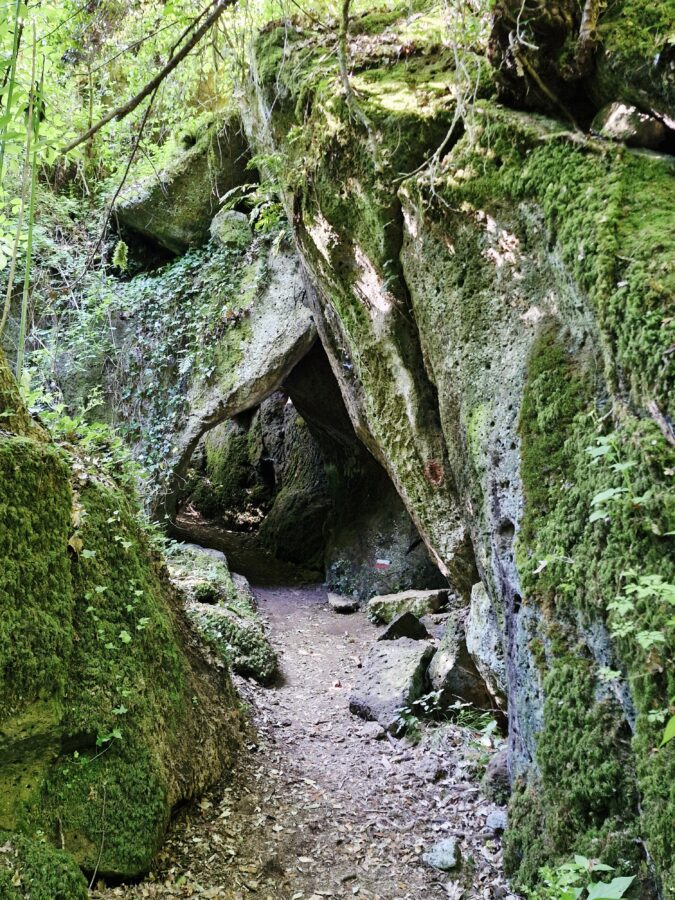
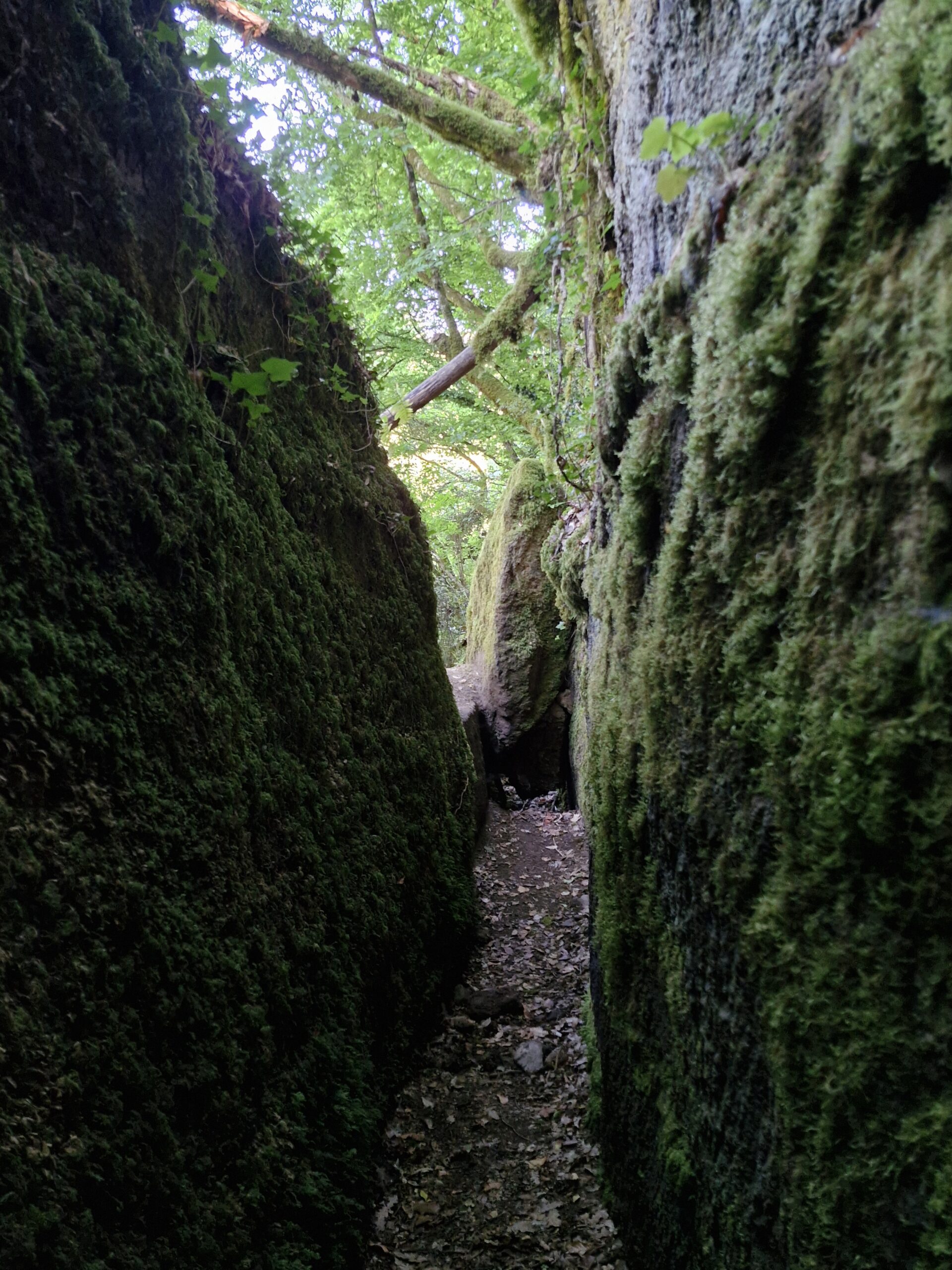
The forest path runs flat at first, then uphill, then downhill in places, then flat again, and is very narrow and steep in places. You have to cross the river two or three times over rocks and pieces of trees, so I wouldn’t go there after heavy rain.
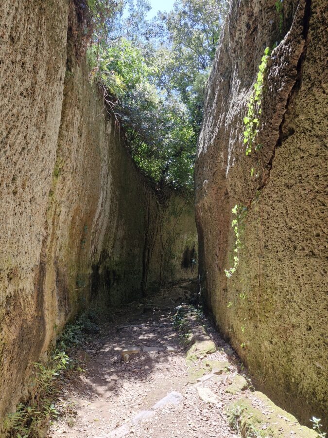
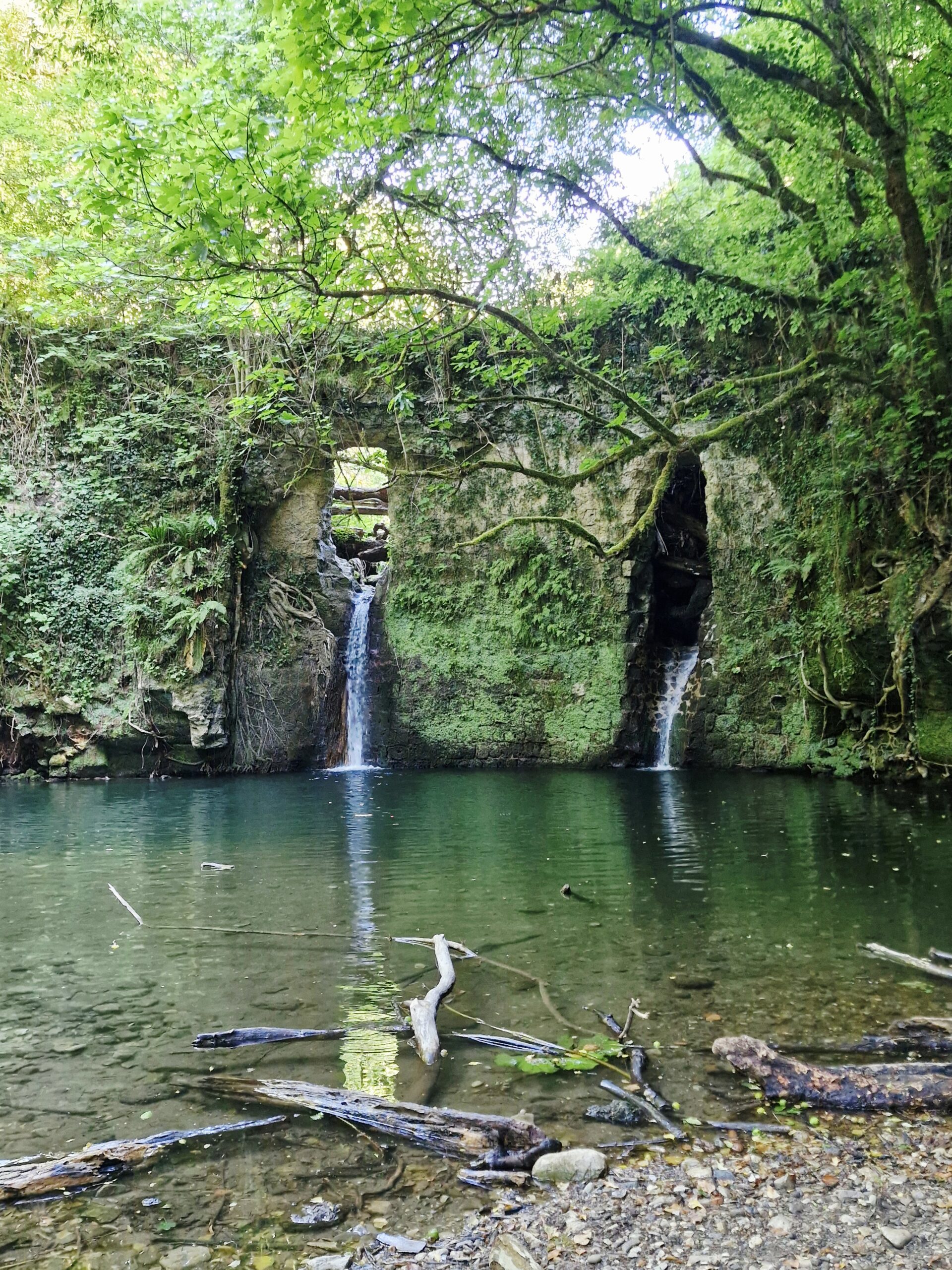
Along the way, we crossed a wall that looked like a stone bridge, from which a small waterfall flowed. On the other side was a very narrow passage between the rocks, something like a canyon. We thought there was a path there, but no, so we returned. If you, by chance or curiosity, cross that high wall that looks like a bridge, turn back.
Trom this point, the route is on the right side of the riverbed. Hiking, I had the impression that we had walked a distance much longer than 5 km and that the sign was deceiving.
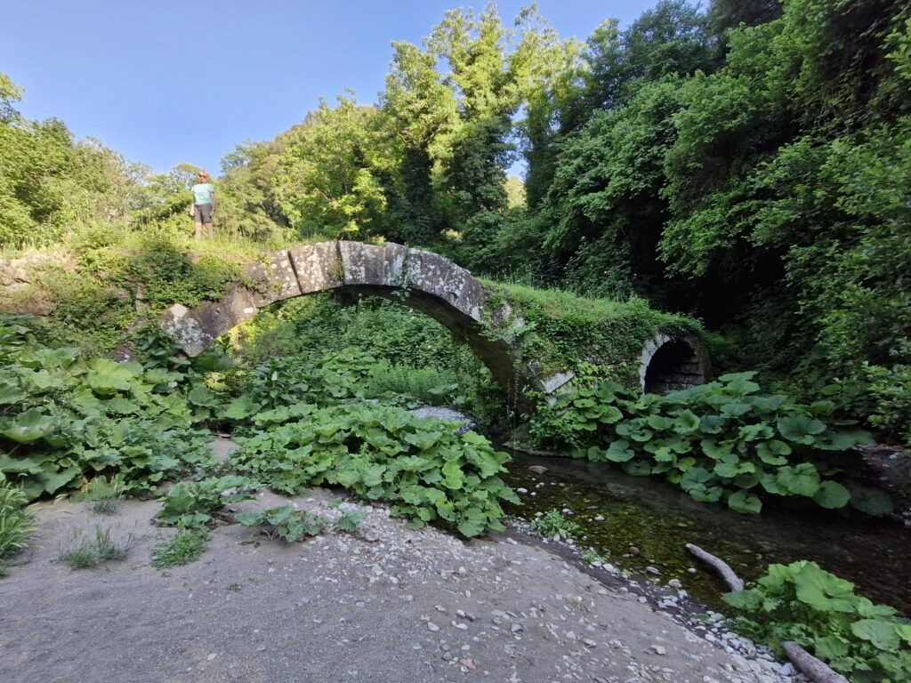
After a while, we reached a small stone bridge – Ponte di Diavolo (there are over 40 of them in Italy), and from there it was just uphill to Blera.
Part 3: Blera to Villa San Giovanni Loop (5 km)
We just had to get back to Villa San Giovanni , or rather to the car – I was starting to feel the kilometres in my feet.
At the entrance to Blera, there’s a sign indicating that the road to San Giovanni leads downhill.
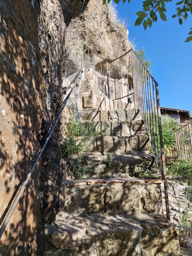
We descended the stairs, then a steep concrete road… And we didn’t know what to do next. There were no people there, no route signs. As is typical in Italy.
Luckily, a local with a dog came along. He said we had to go back up, because the road to San Giovanni goes through the town. He added that there was a beautiful little waterfall nearby, Etruscan tombs ( surprise!), and even an Etruscan road. And that he would take us there.
Frankly, I’d had enough of the Etruscans and their tombs and didn’t want to see any damn waterfalls. But Mauro is less assertive an he’s like a Japanese tourist, who has to take pictures of everything. So he agreed to his suggestion. Luckily, it wasn’t far, but then we had to climb a hill and some stairs.
In the town, we found our way to San Giovanni, and after a 5-kilometre hike along a paved and asphalt road, we reached the car. Walking to the parking lot, we noticed (it was hard not to) that the street curbs were decorated with small lanterns/jars of tea lights.
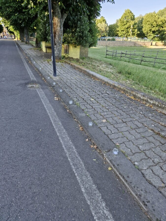
There were tons of them. Perhaps a kind of craziness is a tradition in that region. Ancient inhabitants dug holes in the rocks, and modern ones run along the streets, lining the curbs with hundreds of candles ready to be lit.
Is the Three Villages Trail Worth It?
Yes, definitely. It was long, and my legs felt it, but I really liked how varied it was. You have dirt roads, rivers, forest, uphill climbs, downhill descents, and flat terrain – it’s impossible to get bored, as it be the case on other walking trails in Italy.
And of course, you have the necropolis. It took us 7.5 hours to complete it, but we stopped, Mauro visited as many tombs as he could, etc. And even if I was not so interested in them as Mauro was, I consider this time well spent.
Cammino dei Tre Villaggi: Practical Hiking Tips
- Getting There from Rome: You can drive from Rome to Villa San Giovanni in Tuscia in about 1 hour and 15 minutes. You can also get there by combining a train and a bus, but public transit here is rather unreliable. Just drive.
- Parking: The free parking lot in Villa San Giovanni in Tuscia is large, and located right near the starting piazza.
- Trail Flexibility: You can easily hike the trail in smaller sections, which is what many tourists do.
- Gear: Wear proper hiking shoes, even if you are only doing a short section. Hiking poles are useful for the steeper bits.
- Water Warning: Bring plenty of water. There is no drinkable water along the route; the village fountains are not safe to drink from.
- Sun Protection: If it is sunny, bring a hat and sunscreen.
- Weather Alert: After heavy rain, the forested path through the canyon between Barbarano Romano and Blera can become impassable.
- Timing: A 20 km trek might seem brutal, but the varied terrain keeps it interesting. If you don’t check out every single tomb, you can complete the loop in about 5.5 to 6 hours.