

Betraying my favourite Abruzzo we decided to hike in Marche, which I also like very much.
The Monti Sibillini National Park, and the hiking to Pilato Lake in Marche absolutely did not disappoint us. I plan to return there and explore other trails.
Hike to Lago di Pilato from Foce: Distance, Canyons, and Trail Guide
- Location: Monti Sibillini National Park, Marche, Italy.
- Trailhead: Foce di Montemonaco (945m).
- Max Altitude: 1,940m (Lake basin) / Option to continue to Monte Vettore (2,476m).
- Distance & Elevation Gain: ~13 km round trip with roughly 1,000m of vertical ascent.
- Time Required: 5 to 6 hours total.
- Difficulty: Moderately strenuous. Features a flat start across Piano della Gardosa followed by a steep, slippery gravel scramble through the forest.
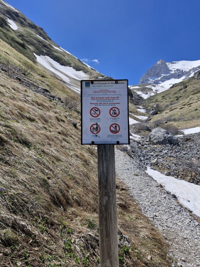
- Crucial Rules: Sturdy trekking boots are mandatory. No dogs allowed past the boundary line. You must maintain a strict 10-meter distance from the shore to protect the endangered Chirocephalus marchesonii (indigenous red shrimp) eggs.
Hiking to Lago di Pilato from Foce – Paking
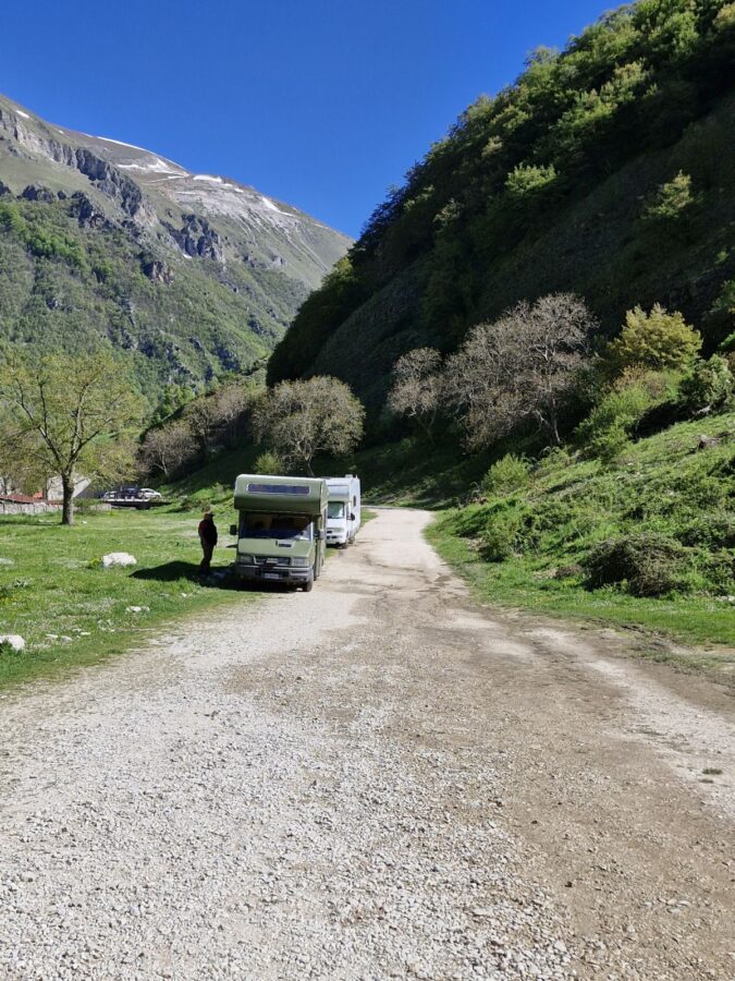
We arrived in Foce early, for us just around 9.30 am on Saturday of the long May weekend. Parking in Foce di Montemonaco was full; there were also cars parked far ahead along the road. I just couldn’t believe that all these people wanted to see Chirocephalus marchesonii – crazy red shrimps living in a pond in the mountains.
Fortunately, Mauro is very skilled and can squeeze the car into even the smallest gaps. We parked, put trekking shoes on, and noticed that the crowds, were all heading the opposite way to another paths. Allelujah!
Finding the Trailhead
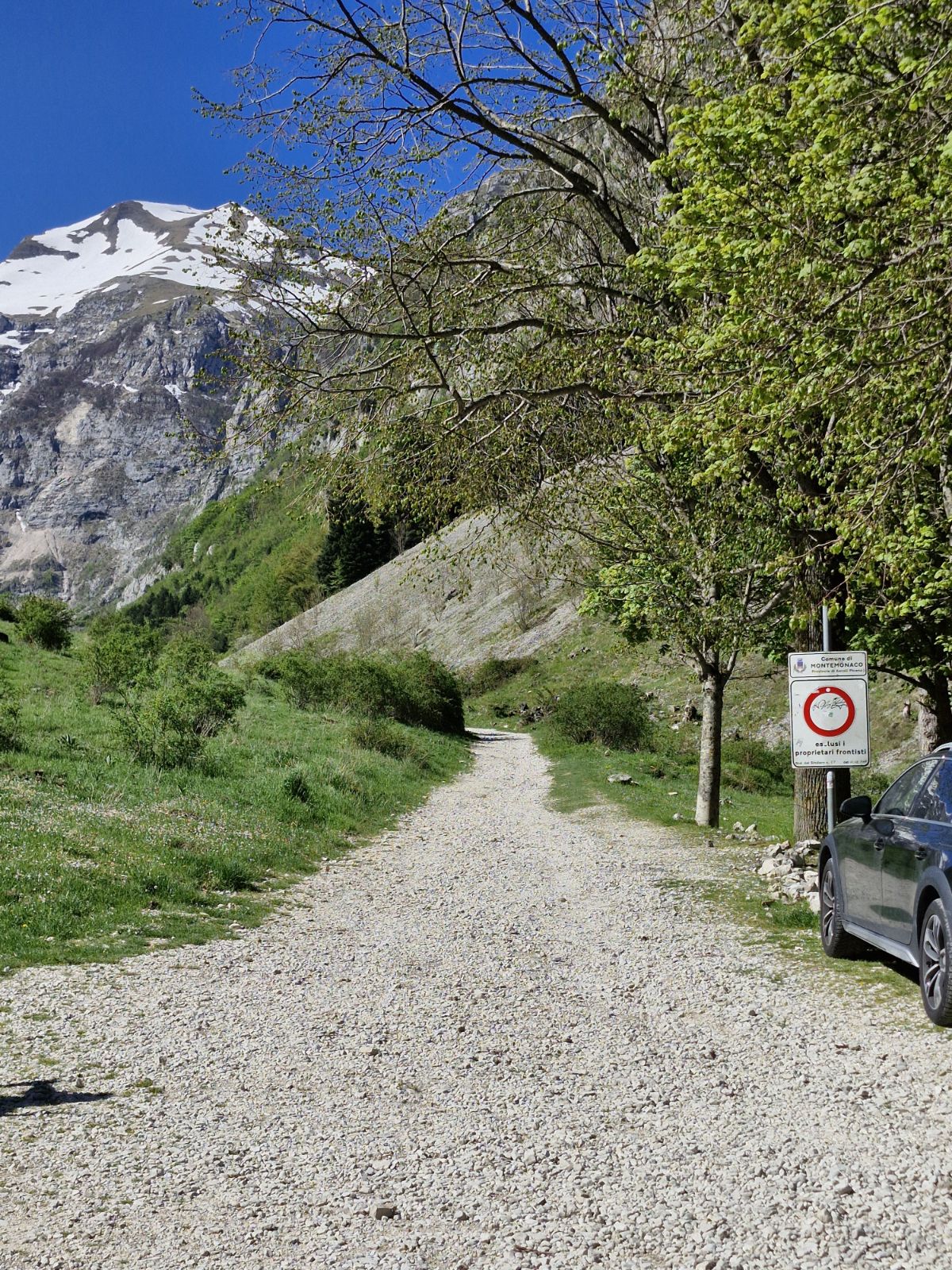
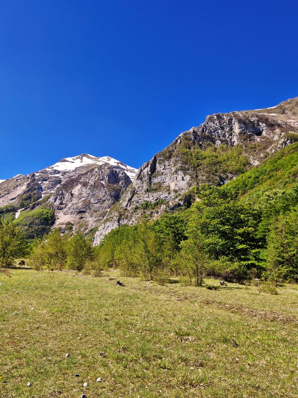
The path to the lake starts in Foce – actually, after it. Hiking through the village, we passed lazy cats and elderly residents soaking up the sun. The village is around 945 m high, but on this sunny and warm spring day, there wasn’t even the lightest breeze. At the end of the houses, we started following a gravel road.
There weren’t any signs, just a fountain close to the gravel road, which was supposed to be there.
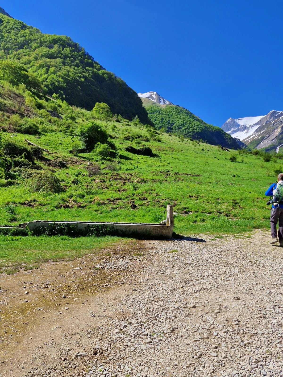
Crossing Piano della Gardosa
Still not totally convinced, we stopped an elderly lady to check our route. Yup, we were OK. She added that she went to Monte Vettore when she was young like me. Right, I’m 57, but it’s nice when during a hike in Italy to Lago di Pilato from Foce a stranger makes your day.
Why walk the plateau
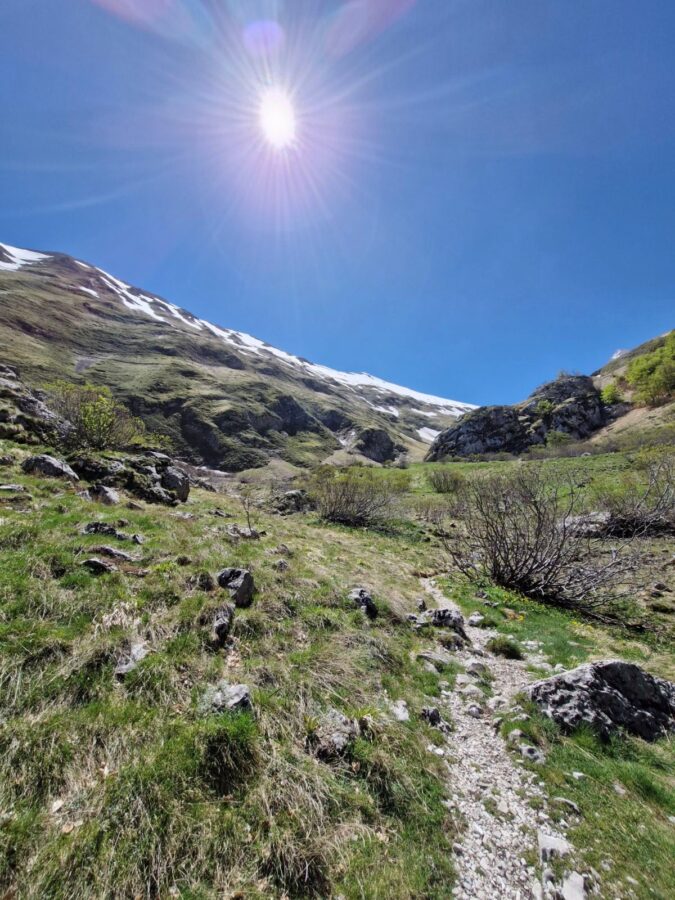
The path goes along the green plateau – Piano della Gardosa, which is better to walk than the gravel path.
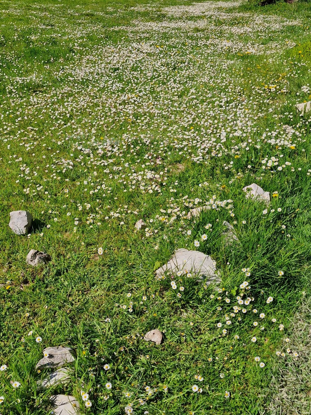
It was full of tiny white daisies, among them blue and yellow flowers boasted their colours. And the mountains were rising in the background. The Piano della Gardosa trail offers you absolutely beautiful views.
Navigating the Gravel Road
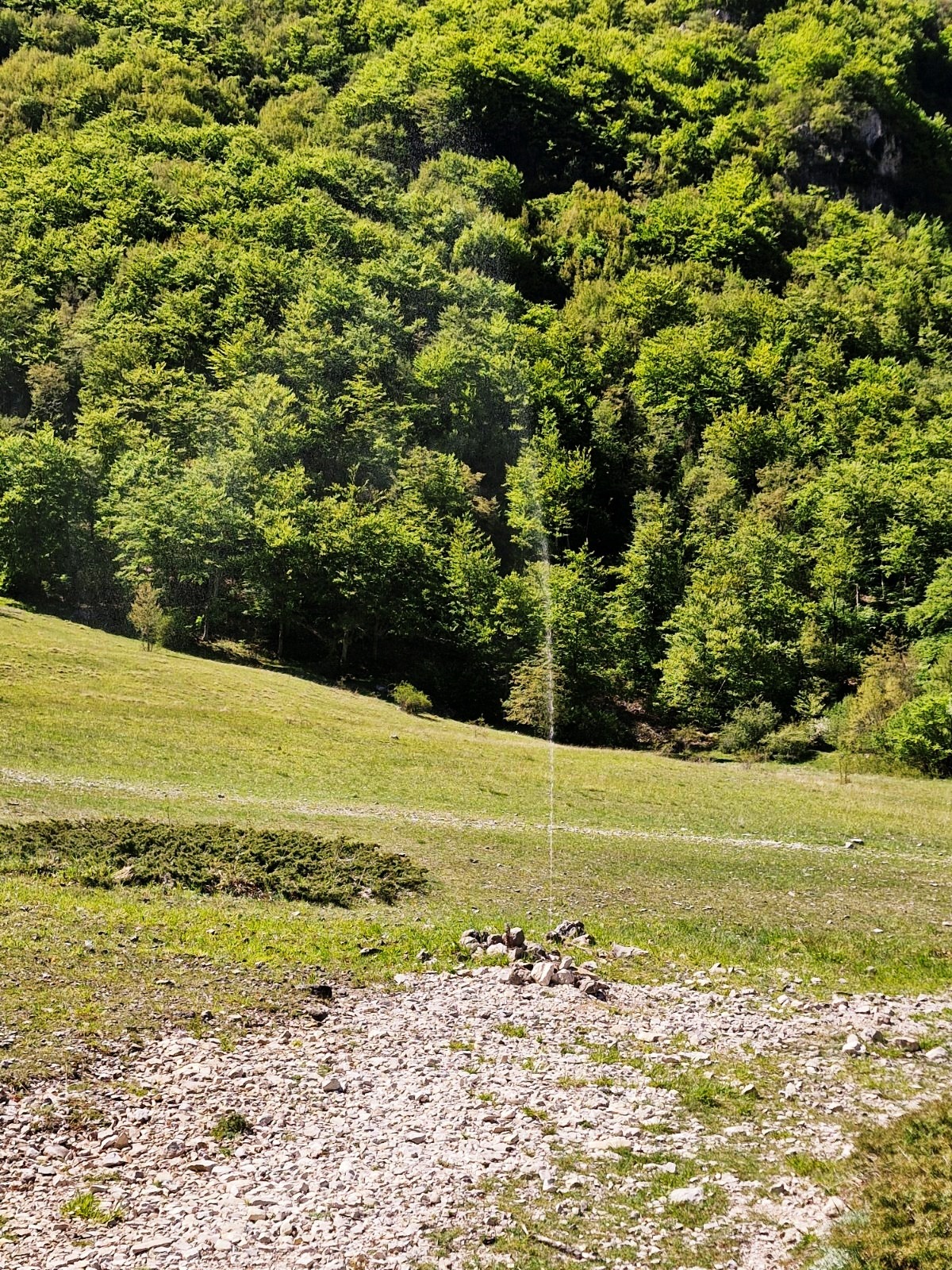
We spot a second fountain (there are two on the track) under a large, lonely tree – there don’t grow many of them, so in summer I’d die without a hat. Approaching the wood, we got back to the gravel path to make sure that we are on the track.
Walking steadily at the same pace, we had already covered 3 km and and had reached an altitude of 1,100 m. So far, so good.
Hike to Lago di Pilato from Foce: The Steep Climb in the Forest
After more or less 40 min we got to the forest – here the fun starts. I looked at the steep, covered with leaves path, and my first thought was – descending will be really interesting.

This part means climbing nearly 800 meters in less than 4 kilometres. Fortunately, I took my hiking poles – I’m pretty talented at slipping even in my super hiking boots.
Going up, we noticed only the first white-and-red signs marking the trail. Italy never disappoints – many paths are poorly marked.
Then the first board warning about the danger of falling stones appeared.
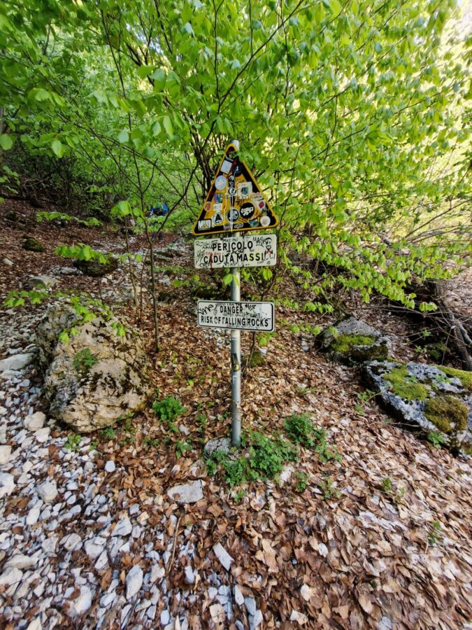
And yes, as we heard a few times, they fall down. They were nice enough not to fall on our heads, but somewhere else – but it was a good reminder that you have to stick to the path and not take any shortcuts.
The Rock Scramble
The leafy hill was still nothing, actually. The next part is the essence of this track – there I started sweating (and swearing under my nose). The path is generally rather narrow, and it gets steeper.
There are stones and pieces of rocks lying everywhere around, some of the climbs are high – i.e., I had to brace myself firmly on one leg, grab a rock or a growing nearby tree and pull myself up. But that’s me – my knees aren’t in the best shape, so you might find it easier.
There are two pretty narrow points, one is close to the cave, the second a bit up, so it’s worth being careful. Actually, the whole path is good to be watchful.
The Forced Freedom of Steep Climbs
Climbing and trying not to kill myself, I understood why I love the mountains, even if sometimes I hate the fact that I love them. Yes, you can spiritually feel as a part of nature, connecting to the mountains, and the space makes you feel free, but for me, it’s another freedom.
I was so focused on not slipping and dying falling down a 900-meter hill (not as impressive as dying on Shkhara for example)| that I couldn’t think about anything else. This is my ‘forced by nature’ freedom—having a blank brain.
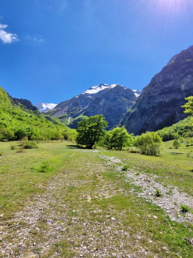
Reaching the High Valley on the way to Pilato Lake
When I had just started regretting (I always regret climbing at some point) what I was doing, the steep and slippery part of the track finished. Allelujah!
Walking a short shadow path, we got to the valley – I forgot all my swearing. The climb was worth the view. Somewhere in my mind, I knew I had to go down, but whatever. At the moment, I was enjoying the mountains.
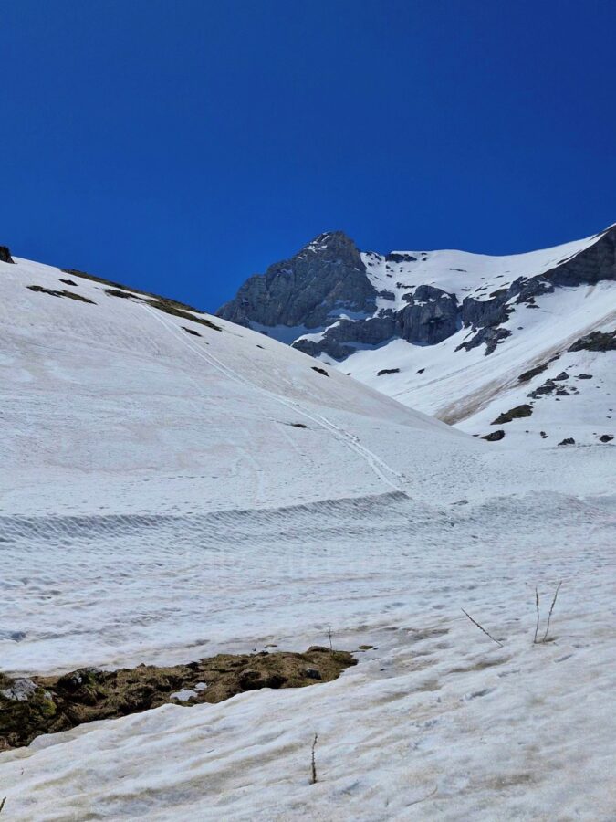
Snow in the High Valley
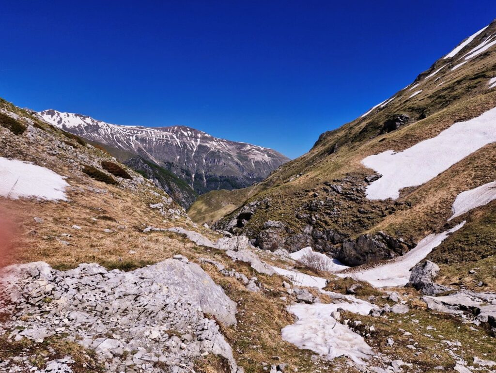
Before we started, we had decided that if there was too much snow, we would go back. In May the snow is no trustworthy anymore; actually, it never is. We stopped, took pictures and walked a well-visible path. The valley is treeless, so no shadow there, but the sun was OK. At some point we faced snow on the path on a flatter part of it – we decided to follow in someone’s footsteps.
1,900 Meters: Altitude and Conditions
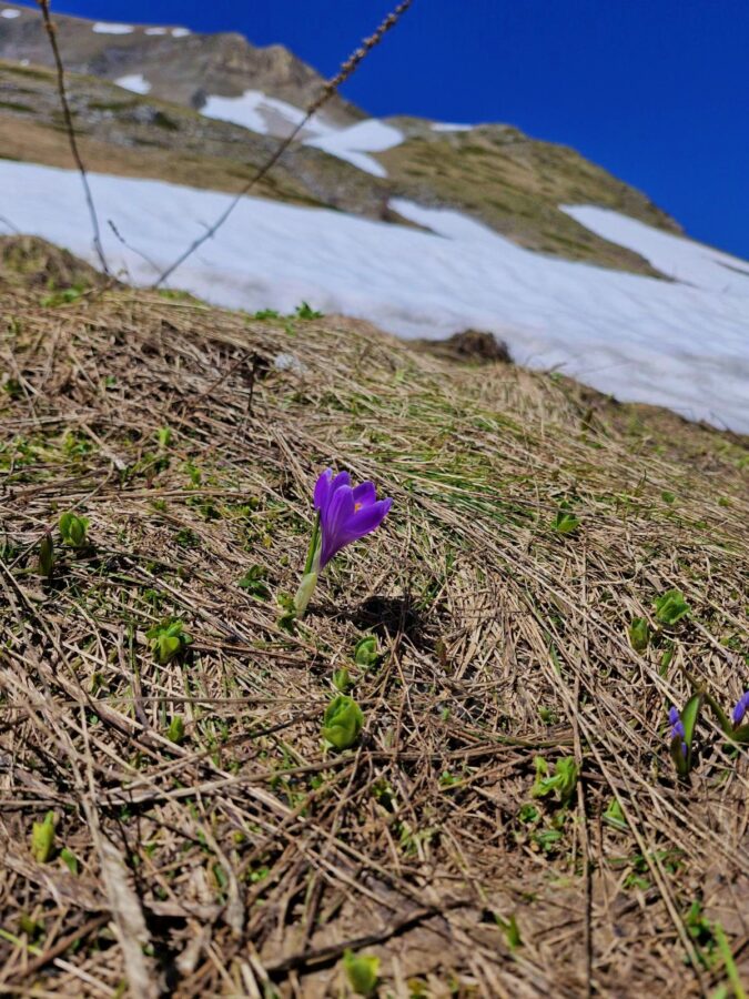
The path in the valley goes up and down, but it’s easy, so I could enjoy the flowers, the mountain landscape, the greenery, the silence broken from time to time by the sound of falling rocks, and squabbling birds. Without trees, they probably live in the low bushes – juniper, I think.
I was captivated by the incredible blue of the sky, without a single cloud – simply nature in its perfect version. Lovely. And then a cold wind began to blow; we were at 1900m.
The Frozen Lake (and Footprints)
Walking, at the horizon we spotted a couple of people, and more and more snow. We kept going until we decided that it might not be safe. After passing a board (protected area) and a small stream, the lake was still ahead.
The path blurred by melting snow was hard to see, so we decided just to climb steep hill. Crossing heaps of snow we reached a place where there probably should be the lake. Maybe it was – just under the snow. Poor frozen shrimps. All around was under snow; we did maybe 100 m more and decided to stop.
My attention caught weird footprints on the snow and of course my bear mania kicked in. The prints were rather wolves-like, at least according to what we later checked online. Bears, wolves… still not a huge difference what eats you.
We saw 4-5 people climbing the steep snowy slope on Monte Vettore, the highest peak in the Sibillini Mountains. Of course the adults are responsible for themselves, but walking up on a melting snow is at least a bit risky. We had our sandwiches and decided to go back. Shame, we didn’t see the lake, but it happens.
The Descent: Why Footwear Matters
As I predicted, going up was easier than going down. The hiking poles were useful, but my bottoms even more – I did the most knee-difficult parts on them. We met two girls wearing trainers trying to descend. When we were down lying on the grass on Piano della Gardosa the girls still didn’t appear.
I know that there are some so-called ‘official’ guides saying trainers is an OK footwear for Monti Sibillini trekking in Marche. No, it isn’t, especially for paths like this one.
Is it worth doing Hike to Lago di Pilato from ?
Is the hike from Yes, absolutely, even in the evening my knees had a different opinion. I know I should avoiding steep climbing, but we shouldn’t do many things and we still do them.
The Valley del Lago is beautiful, the weather was fantastic, tiny flowers were amazing. No the frozen shrimps though, but I can see them in the supermarket. Not the same exactly, but OK. And there I don’t need to keep a 10 meters distance.
Practical Information: Foce to Lago di Pilato
- Parking: Drive through the village of Foce; there’s a lot of space close to the gravel road.
- It’s easier to walk on the Piano della Gardosa, so move there from the gravel path, and head back to it before you approach the wood.
- There are two fountains on the track: the first next to the gravel path and another under a large tree on the plateau.
- There are more fountains on the plateau, but they’re not close to the path.
- If you forgot a bottle, you can buy one in a bar -restaurant ‘Taverna della Montagna’ and a tiny shop in Foce. Remember, they might be open late at weekends.
- Trekking boots – highly recommended.
- Trekking poles are very useful for the steep forest section and the descent.
- Bring a hat and sun cream, especially in the summer. The valley is treeless, and the sun might be very strong.
- Pack layers. Even if the weather is great, on this altitude the wind can be strong and cold.
- In the late the spring the path in the Valley di Lago still can be partially or fully under snow. If the snow looks unstable or you don’t feel safe, just stop and go back.
- Just because some hikers climbing the steep snowy slope toward the peak, it doesn’t mean you have to do the same. Everyone is free to choose their own adventure at their own risk.
- The path isn’t technically “mountain climbing,” but it might be difficult for the knees, as the trail is steep and slippery in places.
- No shortcuts. Stick to the marked path to avoid causing erosion and to stay out of the way of falling rocks.
- Passing the “protected area” board doesn’t mean you’ve arrived. The lake is still a significant walk ahead.
- The Shrimp Rules: This is a protected area. It is strictly forbidden to get within 10 meters of the lake shore to protect the Chirocephalus marchesonii eggs.
- There’s no signal and the Internet in the Valley. It’s worth downloading your GPS maps for offline before you leave Foce.
- The valley is wide and treeless. If you need to go, do it in the forest. In the valley, you have to find a place behind a hill.
- When you’re on the “easy” hills in the valley, it’s easier and better for the knees to descent jogging than walking.
- The Path Doesn’t End at the Lake – you can continue up the trail to Monte Vettore (the highest peak in the Sibillini).
If this post made you laugh, annoyed you, or just reminded you of your own trip, tell me in the comments or drop me an email. I actually want to hear about your experiences—the good and the frustrating.
Sign up for the newsletter for one post a week (usually Wednesdays at 6:00 PM). No spam, no “magical Italy” fluff. Just honest stories and places off the beaten track. I’ll see you there!